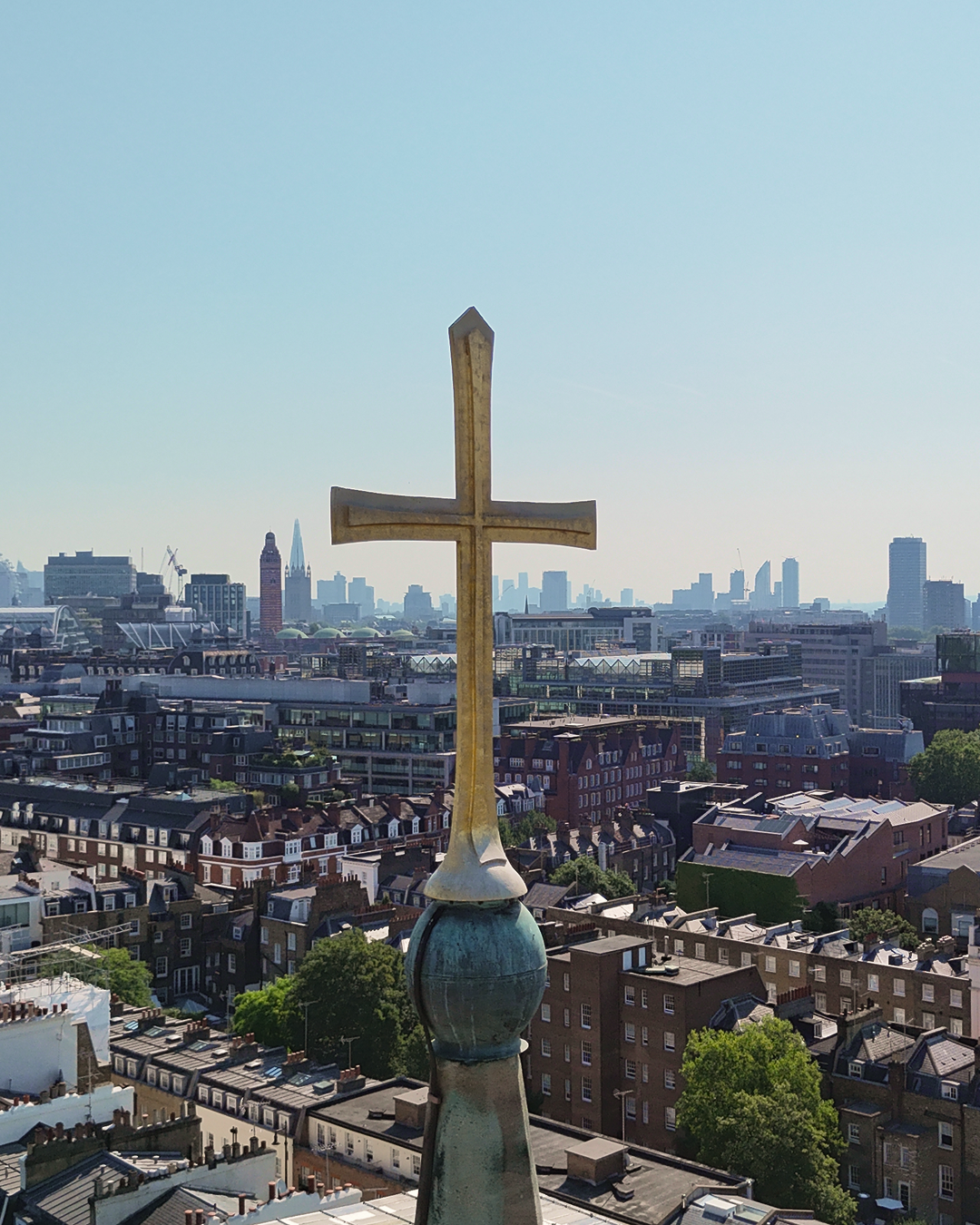
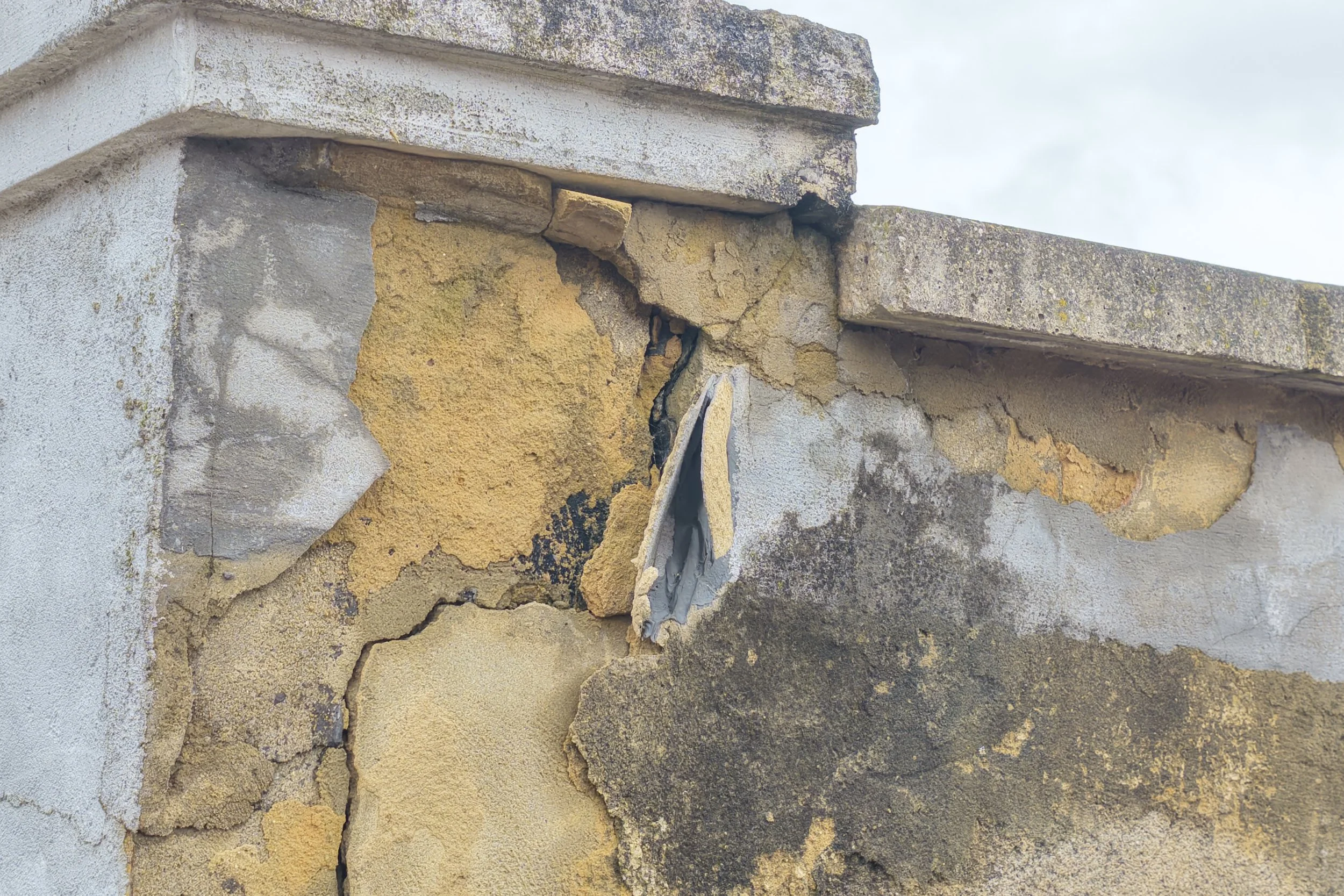
A Drone Survey of St Michael's: Planning Access, Reading a Crack, and Knowing When to Stop
We were commissioned by Universal Stone to carry out a drone inspection of the spire, church roof and tower at St Michael's, Chester Square. The survey gave them accurate height measurements to plan for spider cranes and cherry pickers on site, and helped them understand the extent and urgency of the repair works needed.

Drone Survey Documents Roof Deterioration at Historic Sheffield Building
Commissioned by the Victorian Society, this aerial survey of a historic Sheffield building revealed significant roof deterioration and previously unseen structural damage. Using high-resolution drone imagery, CAV Aerial documented inaccessible areas from above, providing a detailed visual record that highlights the value of drone surveys for heritage buildings, conservation projects and historic property inspections.

Returning to a North London Renovation Project: What Changed After the Roof Repairs?
Documenting the Victorian Society’s Top Ten Endangered Buildings 2026
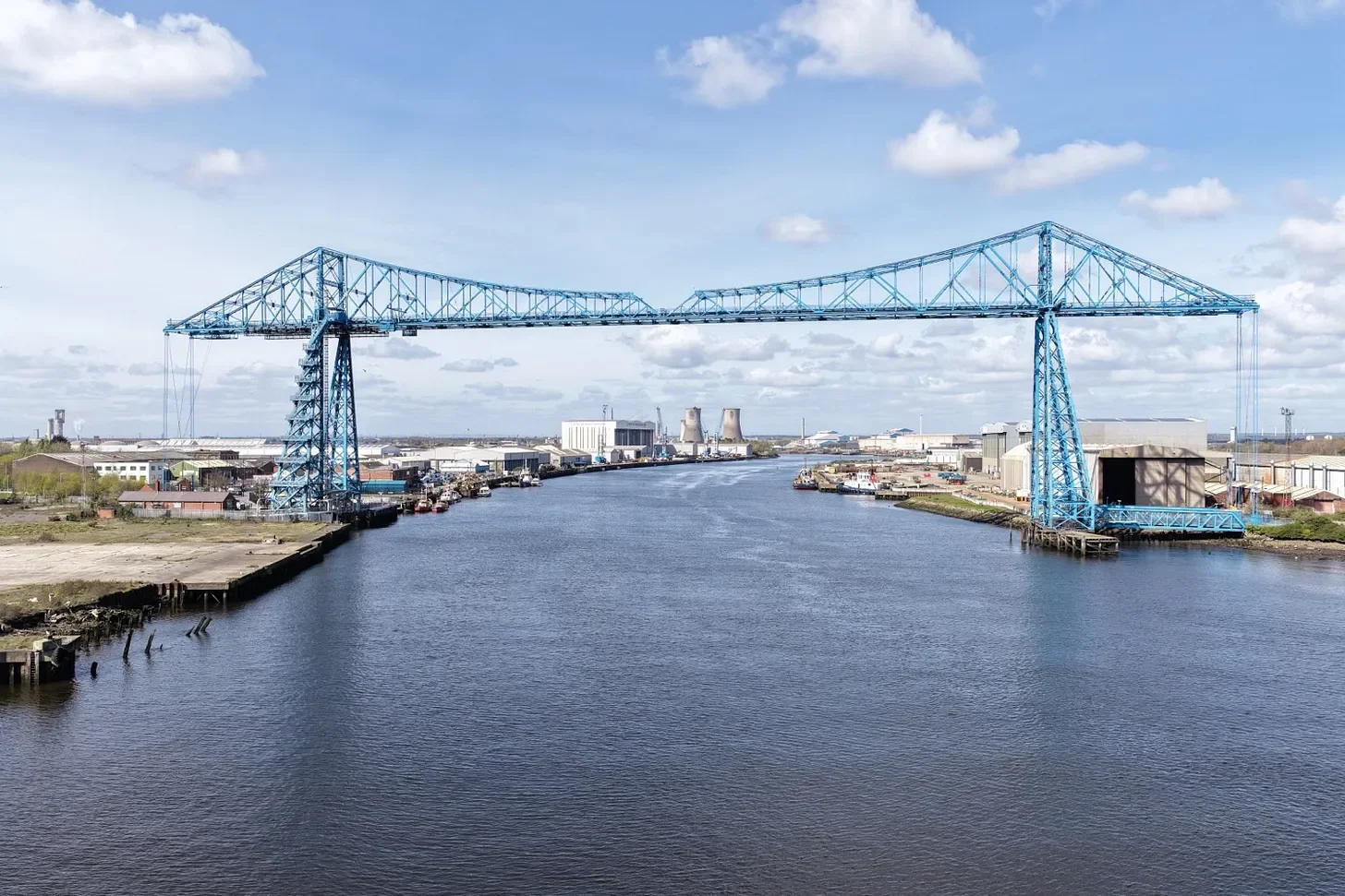
CAV Aerial was commissioned by the Victorian Society to help document several buildings featured in their Top Ten Endangered Buildings 2026 campaign. Travelling across England and Wales, the project involved aerial documentation of historic buildings and industrial structures facing severe deterioration, roof collapse and long-term neglect, including the Tees Transporter Bridge and Hackney Borough Disinfecting Station.
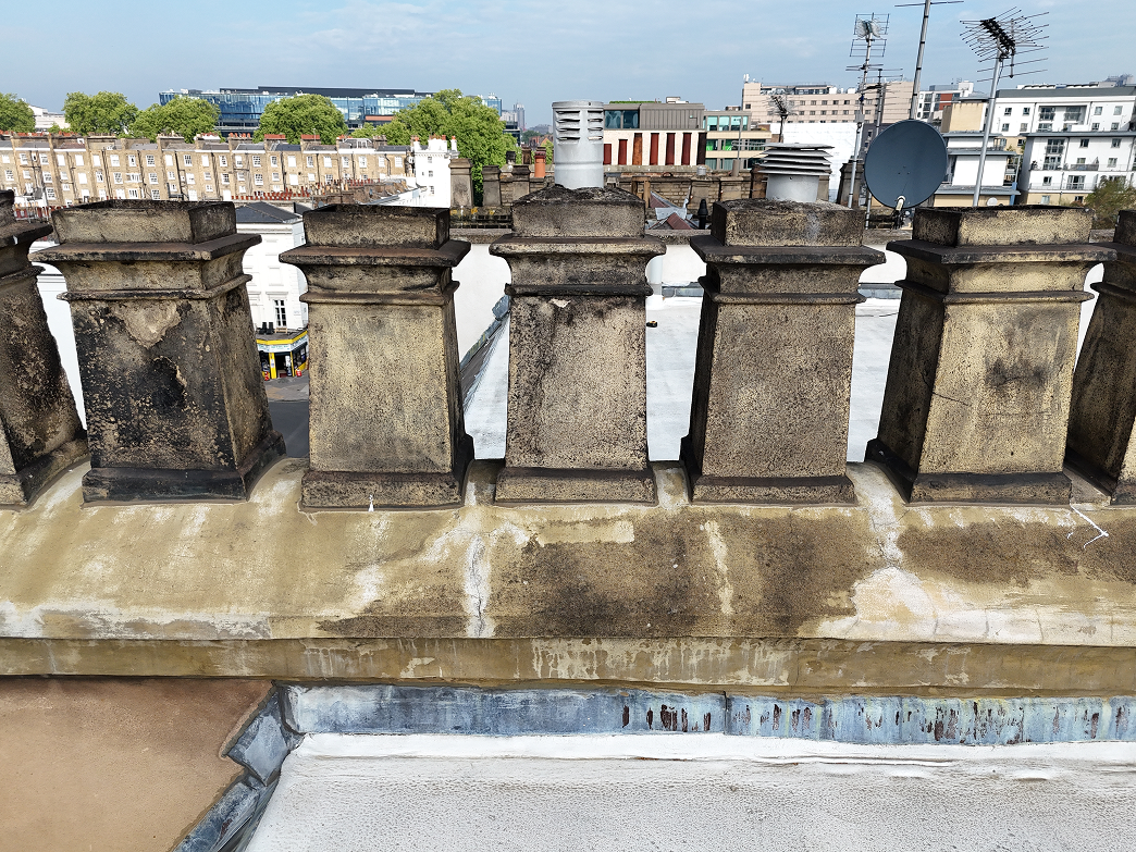
Roof Inspections for Property Managers in Pimlico
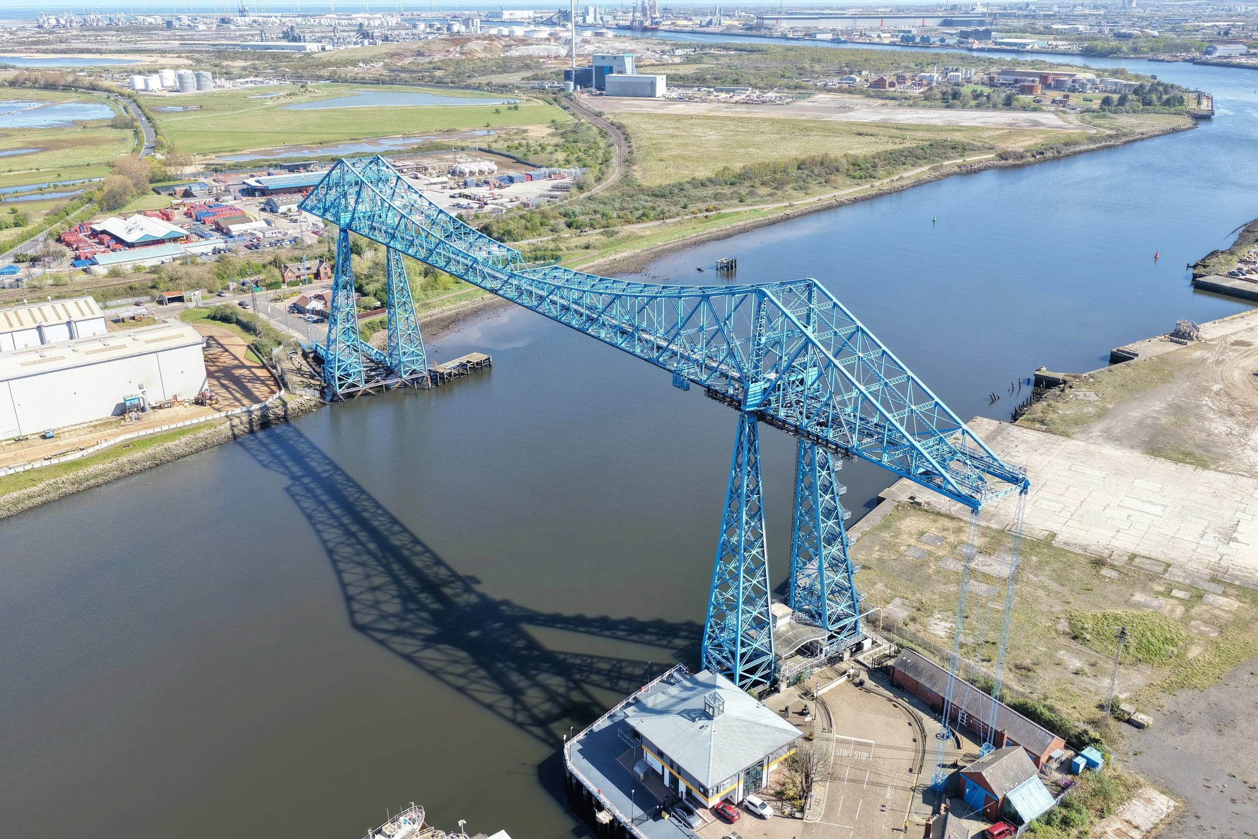
Documenting the Tees Transporter Bridge from Above: A New Perspective on an Endangered Landmark
Using precision drone operations, CAV Aerial documented the Tees Transporter Bridge for the Victorian Society’s Endangered Buildings 2026 list — capturing perspectives and structural details impossible to see from the ground, and helping bring national attention to one of the UK’s most important industrial landmarks.
Detecting Hidden Roof Defects in a Grade II listed Hampstead Renovation Project
A drone roof survey carried out in Hampstead during a renovation, identifying broken tiles, slipped slates and other visible defects without the need for scaffolding.
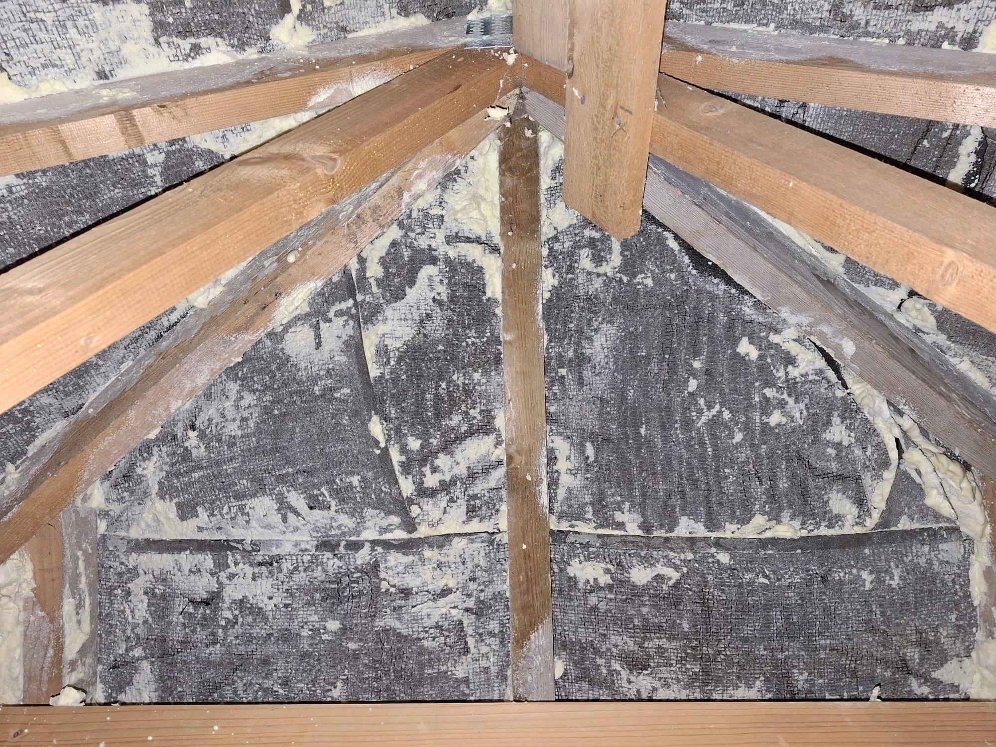
Spray Foam Insulation: Risks, Removal Issues, and Independent Inspection
Spray foam insulation can lead to serious issues during sale and removal. Learn the risks, common removal defects, and how independent inspections can provide clear, impartial documentation.
Drone & Internal Roof Survey in Highgate: Chimney Leaks & Damp Investigation
A drone and internal roof survey in Highgate identifying chimney defects, damp, and hidden water ingress without the need for scaffolding.
Drone Roof Survey of Hornsey Parish Church, Muswell Hill
A drone roof survey of Hornsey Parish Church in Muswell Hill, carried out in collaboration with a local architecture practice. High-resolution imagery helped identify vegetation growth and provided clear visual evidence to support targeted maintenance planning.

How We Helped a Property Management Company Save Time and Money with a Drone Roof Inspection in Highgate
CAV Aerial worked with a chartered surveyor to carry out a detailed drone roof inspection of a Highgate residential block—capturing 100+ RAW images and 4K video, identifying leaks and defects, and delivering organised files within hours.
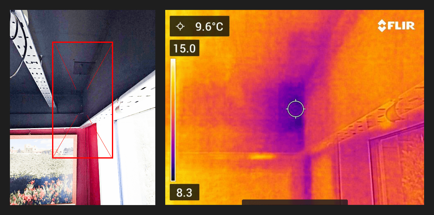
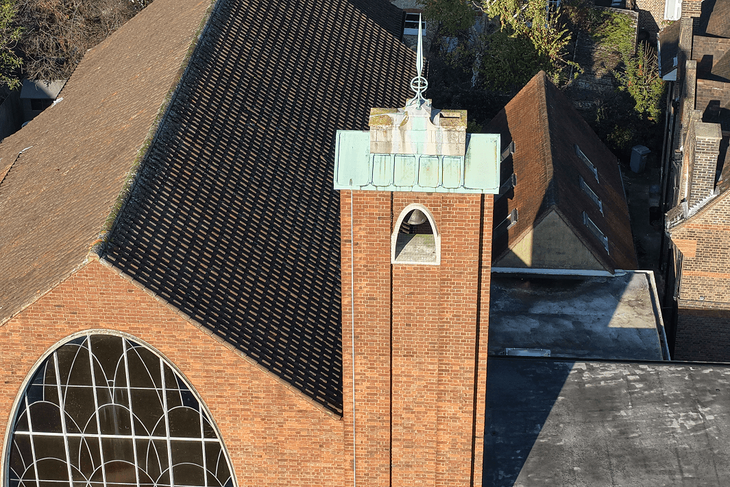
Thermal Imaging for Commercial Property Inspections in London
Thermal imaging is a powerful, non-invasive tool for investigating hidden issues within commercial buildings. In this London inspection, a FLIR thermal camera was used to compare stable background temperatures with localised anomalies beneath a roof garden, helping surveyors better understand conditions behind walls and ceilings without intrusive works.
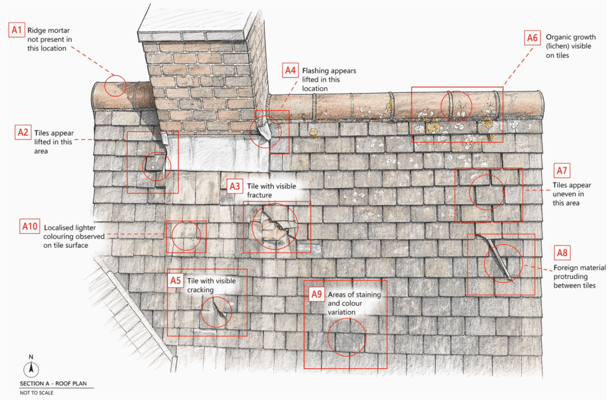
How We Produce Clear, Visual Roof Inspection Reports
Insurance Roof Inspections & Claims Support – Victorian Property, Wimbledon
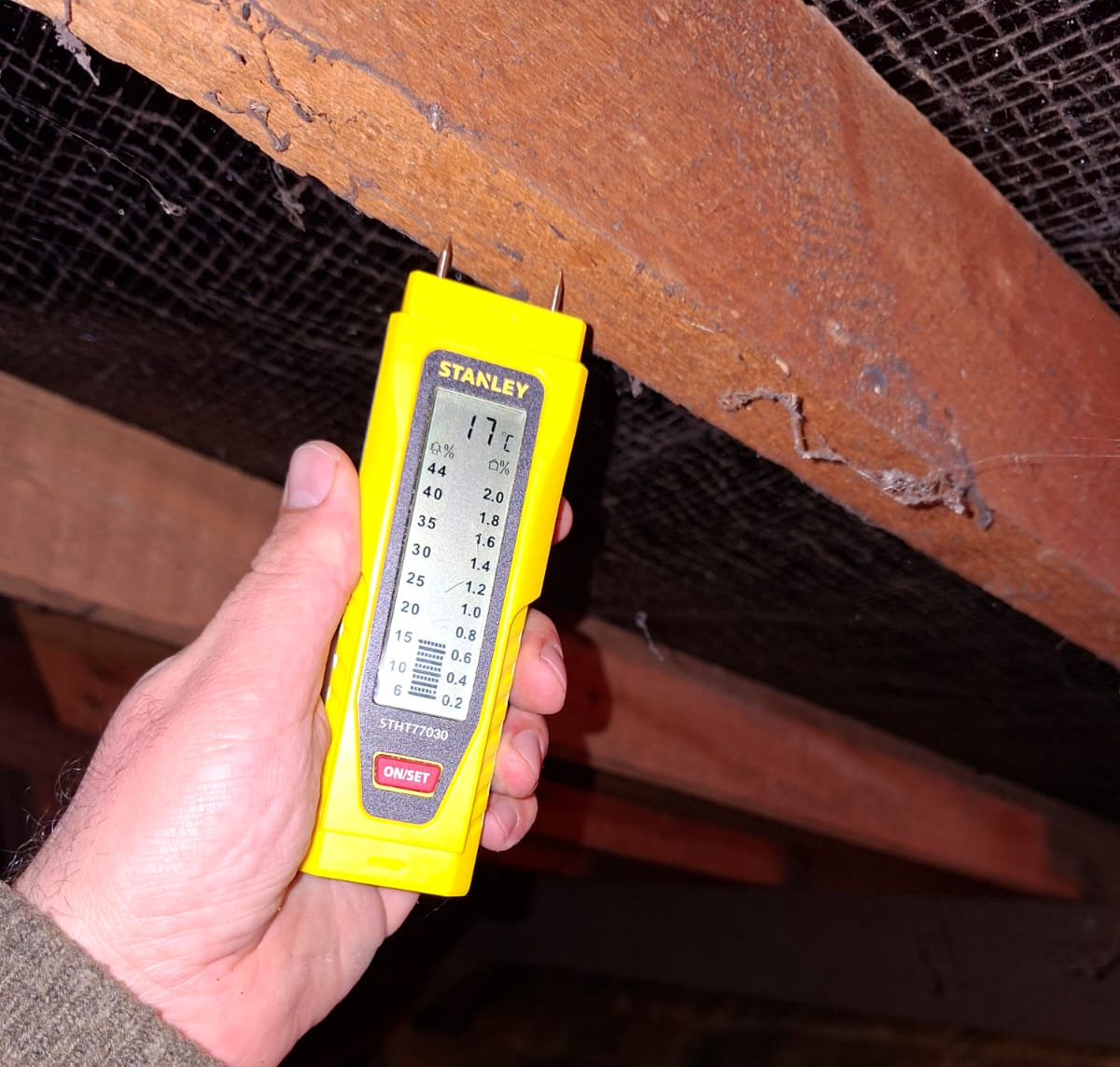
Internal Attic Inspections
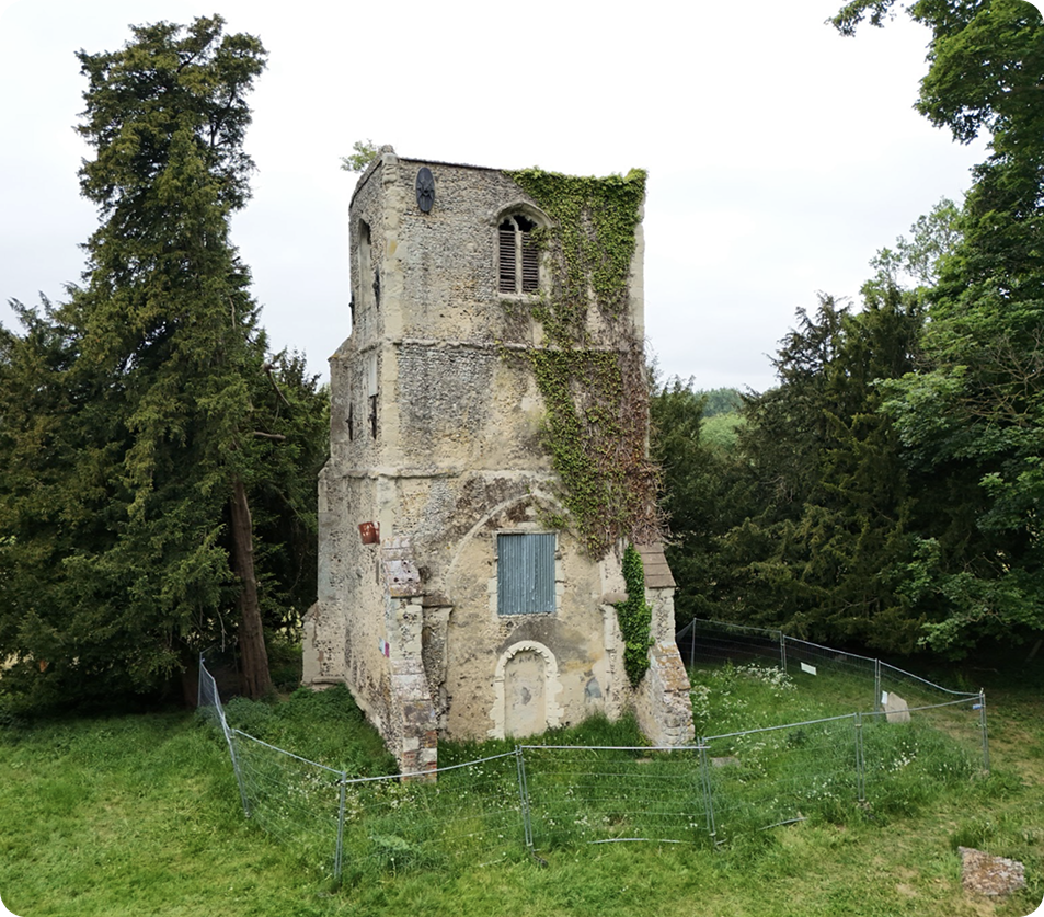
Five Historic Churches We Worked Around in 2025
In 2025, we worked with a range of historic churches across England, producing aerial documentation to support conservation, interpretation and long-term care. From early medieval chapels to later parish churches, each site offered a different perspective on England’s built heritage.
Five Heritage Sites We Surveyed in 2025 – A Year in Conservation from Above
In 2025 we were fortunate to survey five remarkable heritage sites across London, from Tudor towers to historic gardens and Victorian landmarks. These aerial inspections supported conservation teams with high-resolution imagery, condition insights and accessible documentation that would be difficult to achieve from the ground.

Common Roofing Design Defects We See All the Time in London (And How Drone Surveys Spot Them Instantly

Client Feedback: We saved a client thousands by detecting a roof leak
We were called by a block manager in South West London to investigate a possible roof leak. Using our drone, we quickly identified signs of staining and blocked gutters, without any need for ladders or scaffolding. By comparing both sides of the roof, we pinpointed the likely source of the problem and provided clear images for repair planning. If you need something on your roof looked at, we can carry out a quick, affordable, and non-intrusive drone inspection anywhere in London.
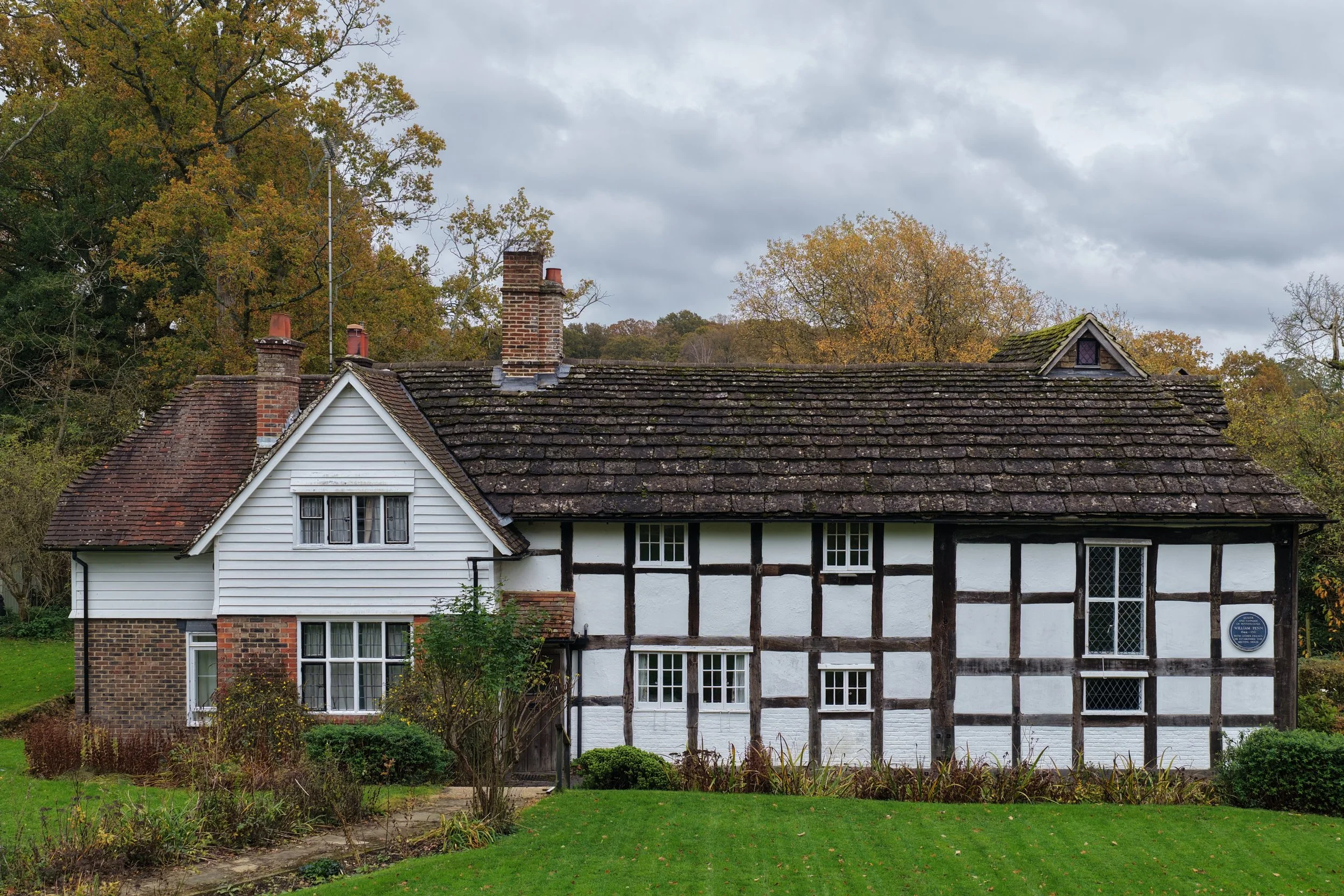
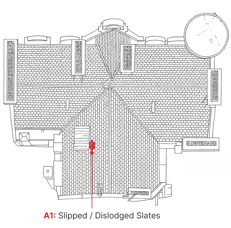
Preserving the Past from Above: A Drone Roof Survey of The Blue Idol Meeting House
The Blue Idol Quaker Meeting House in West Sussex is one of the region’s most significant early buildings, with origins stretching back to the 15th century and historic links to William Penn. Nestled in the rural landscape near Coolham, its distinctive Horsham stone roof is both beautiful and fragile — making careful conservation essential. Our recent drone survey identified cracked stones, slipped tiles, vegetation growth and blocked gutters, providing the trustees with a 4K flyover and a traffic-light condition report to prioritise repairs while preserving this remarkable heritage site.