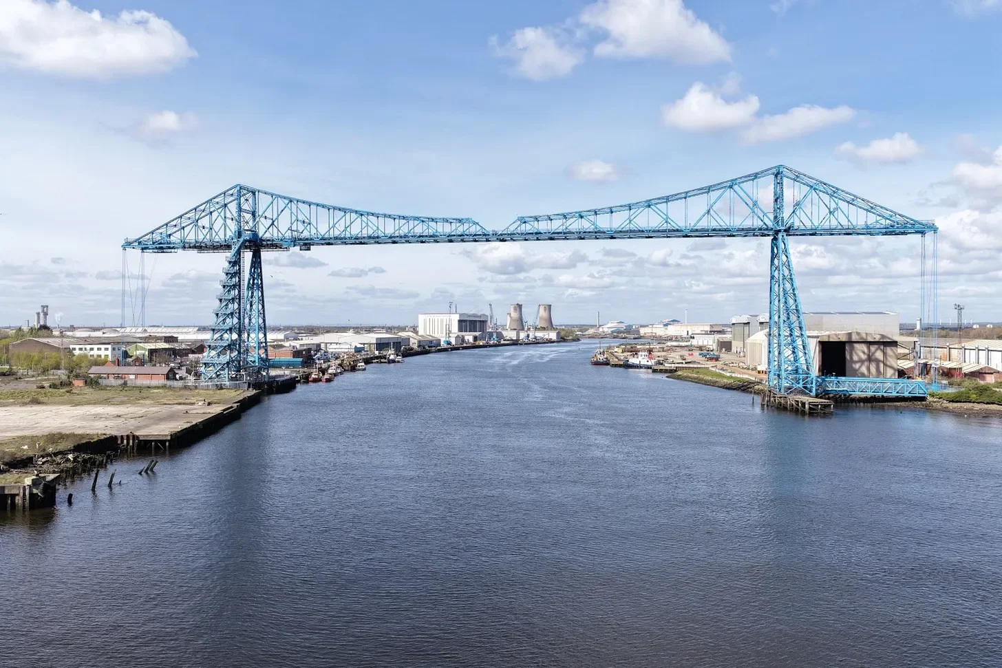
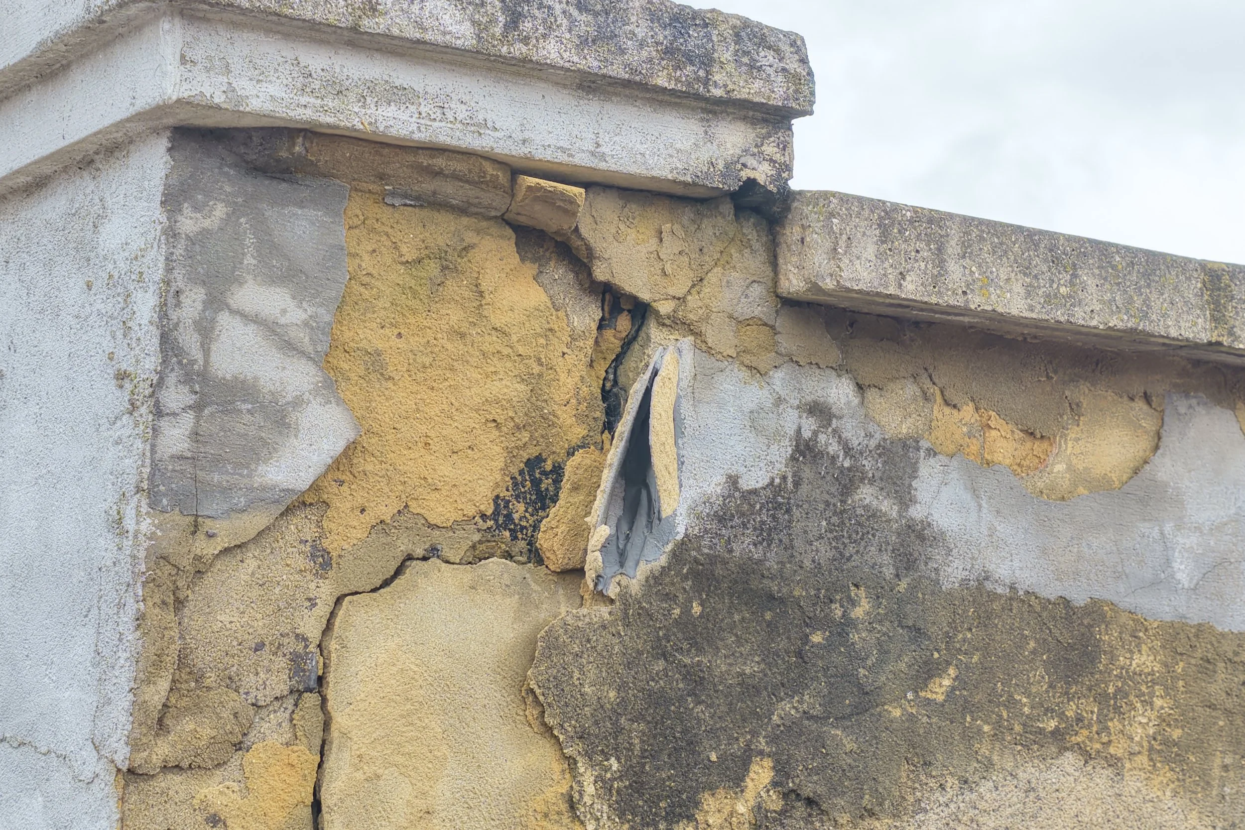
Victorian Society’s Top Ten Endangered Buildings 2026
CAV Aerial was commissioned by the Victorian Society to document several buildings featured in the Top Ten Endangered Buildings 2026 campaign.
Featured in BBC, ITV, Time Out and leading UK architecture & heritage publications

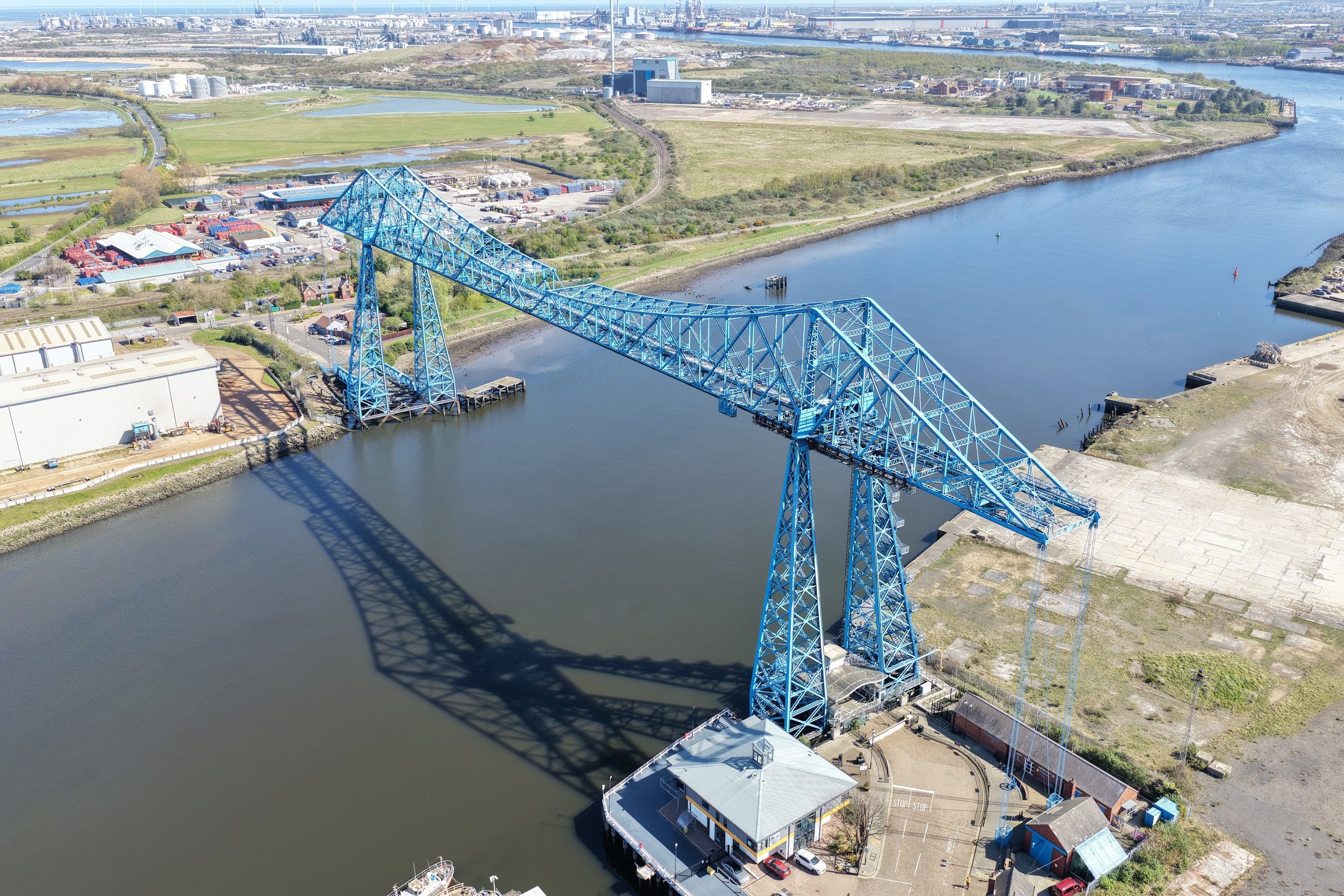
Latest Project:
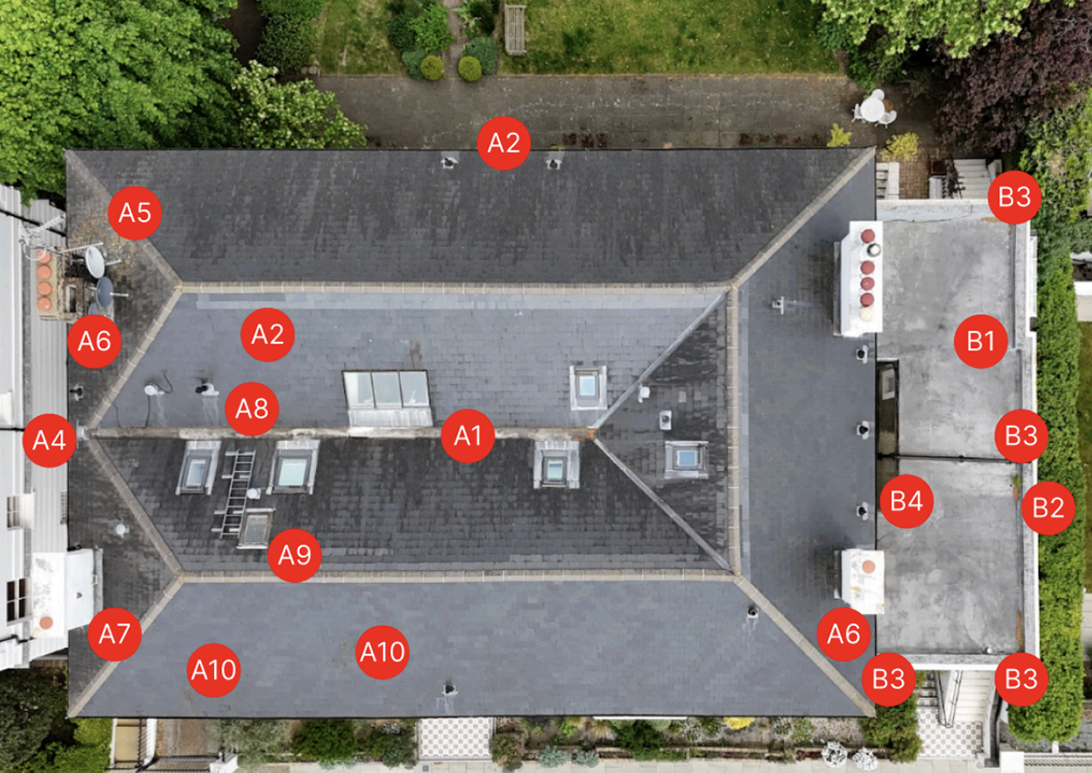
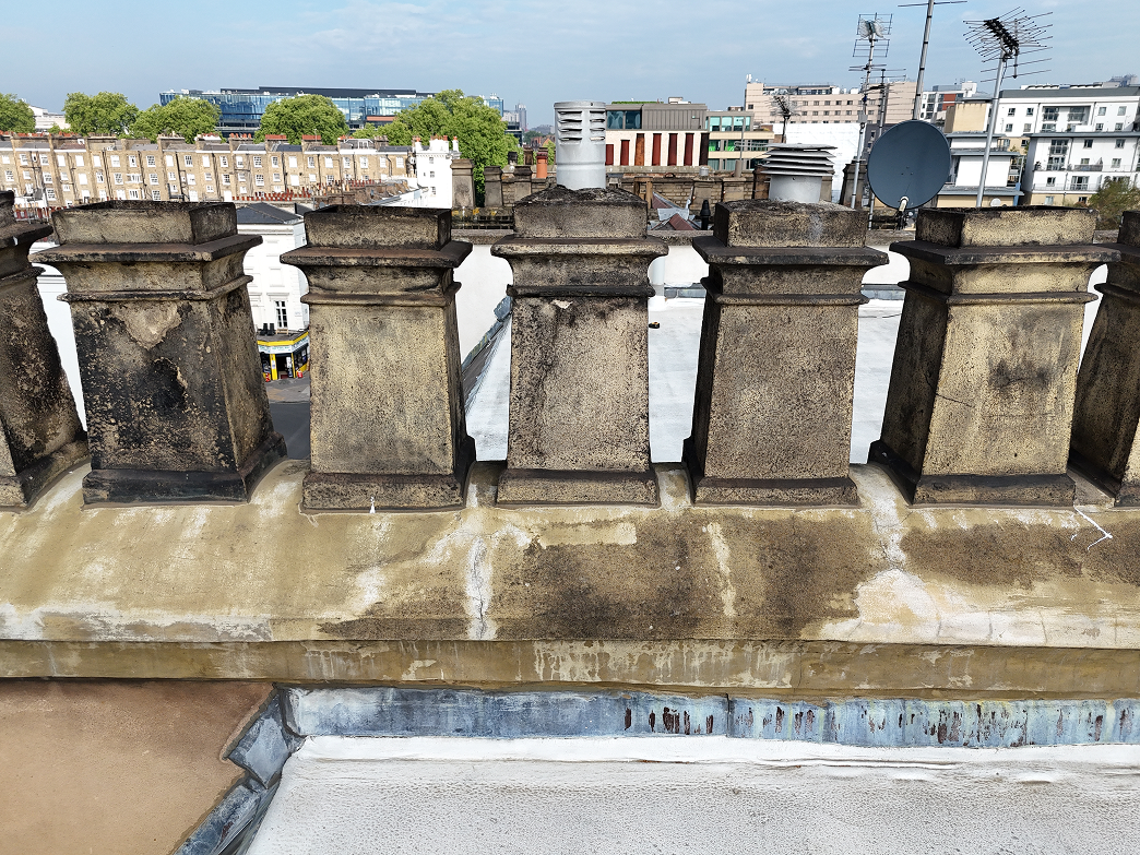
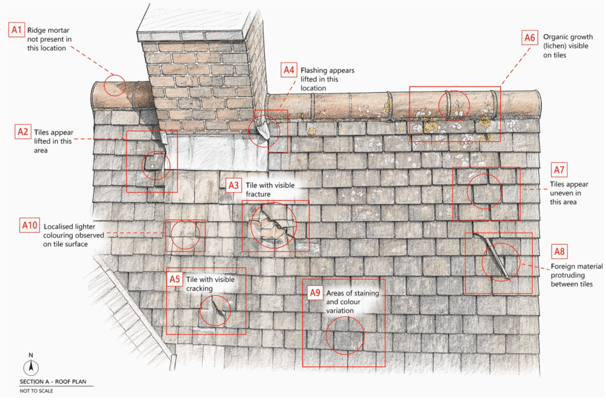
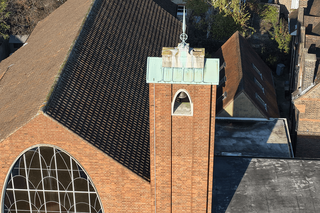
Following our initial roof inspection, we returned to document the remedial works carried out by the contractor and compare the condition of the roof before and after repairs.
>Read the case study here.
Specialist Inspection & Documentation Services
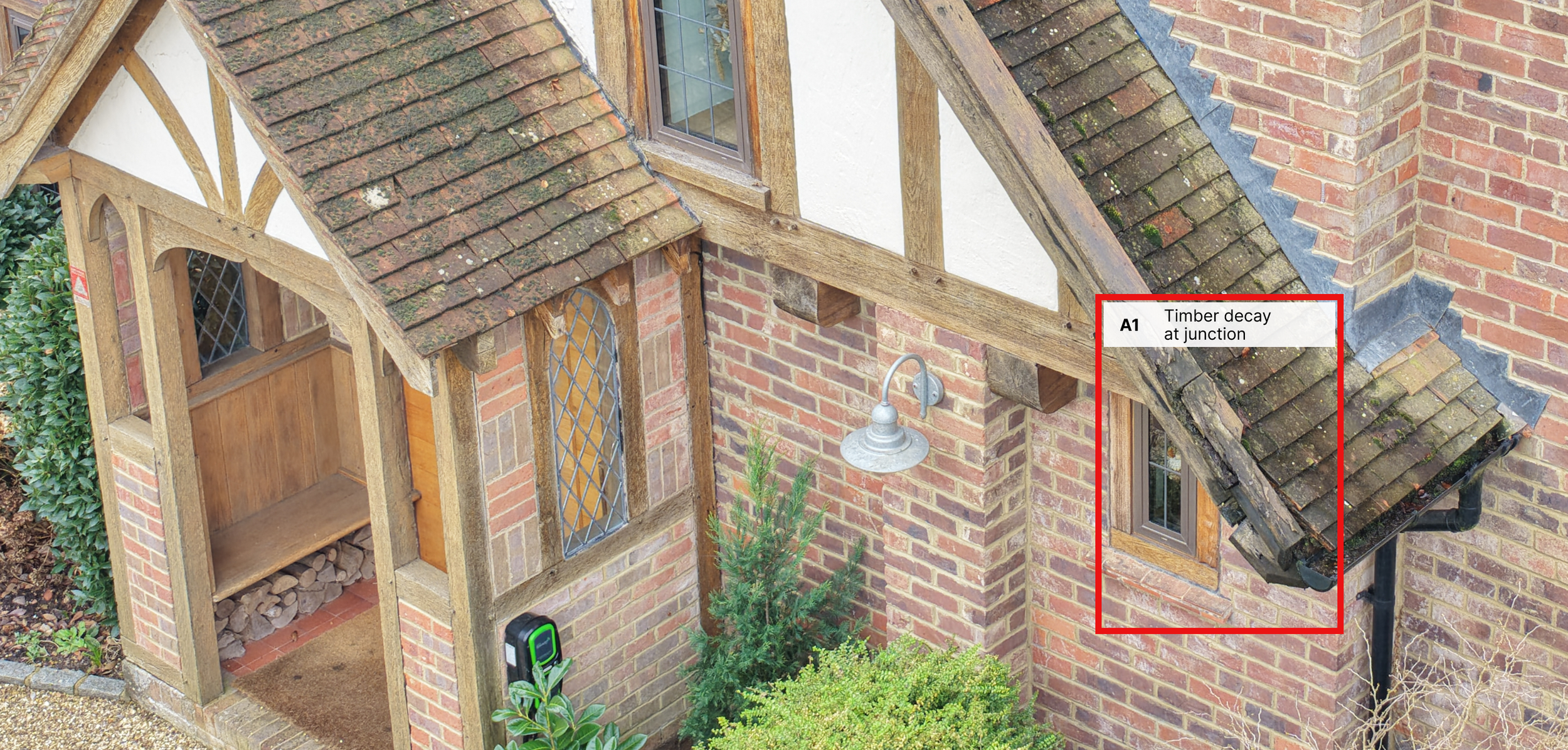
Independent inspections for residential, commercial and heritage properties, including defect reporting, leak investigations and pre-purchase assessments.
Roof & Building Inspections
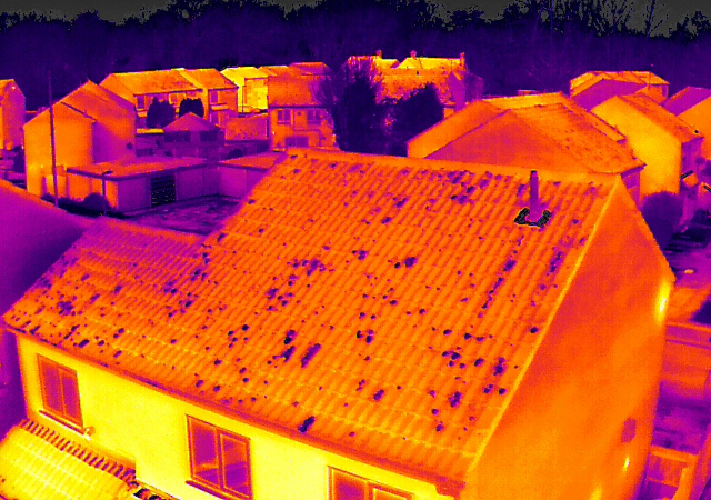
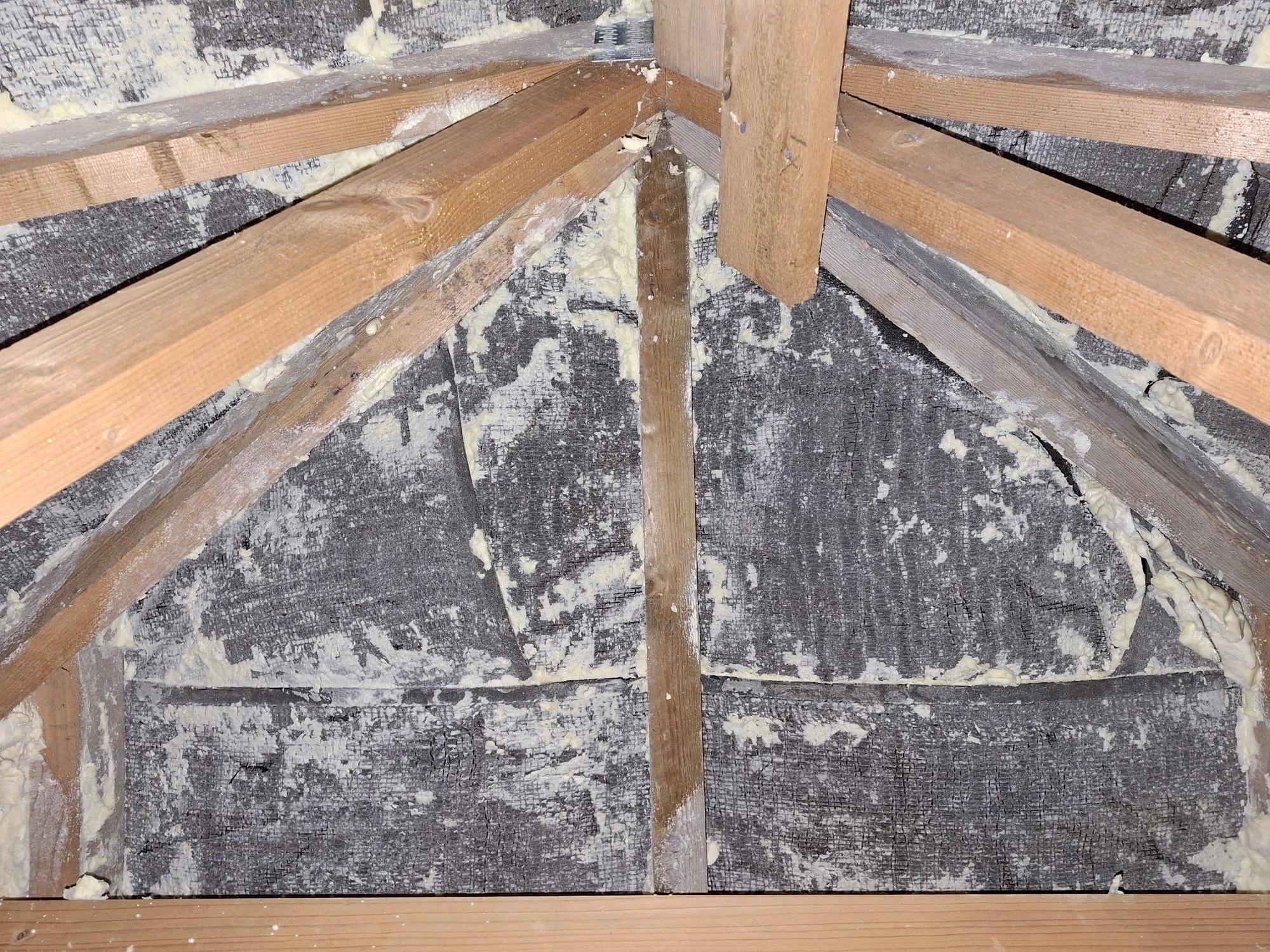
Thermal assessments and visual defect identification for roofs, buildings and hard to-access areas.
Thermal & Defect Survey
Heritage & Conservation Documentation
Documentation and visual surveys for historic buildings, trusts and conservation organisations.
Portfolio & Asset Surveys
Large-scale inspection programmes for property portfolios, estates and managed assets
Latest
Google Reviews

“CAV Aerial went the extra mile for our Liverpool Street Station campaign — fast, creative and a pleasure to work with…

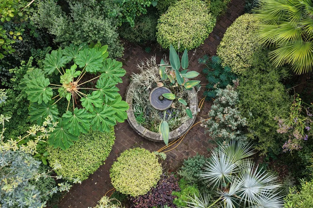
“Fresh, thoughtful and beautifully shot footage. It brought London’s gardens to life…

Full of flair and artistry. They captured the beauty of my garden perfectly…

Our Clients


Recent projects


Contact Us
Have a roof survey, heritage project, or garden shoot in mind?
Send us a message and we’ll get back to you shortly. Whether it’s a single property or multiple sites, we’re ready to help.